Todd Mitchell
GEOG-499c
|
Lab 6: A Project on Suitability |
|
Description of the project: The objective of this project is
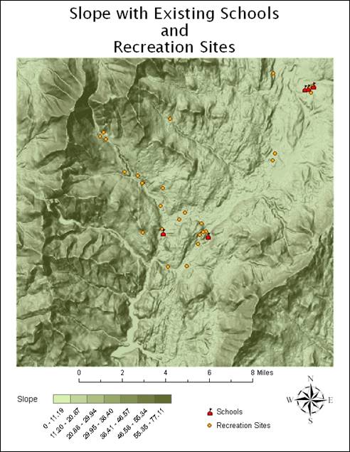
to look for suitable locations for a new school. Factors considered include: 1. Slope: the flat, the better. 2. Close to recreational places:
the closer, the better. 3. Distant from current schools:
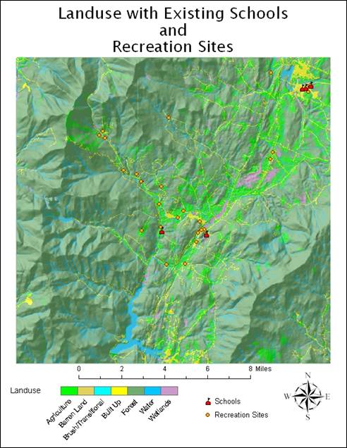
it is desirable to have schools evenly distributed. 4. Certain landuse
types are better for building a school than others and the following is the
rank, from the best to the worst. a.
Agriculture...............best b.
Barren land c.
Brush/transitional d.
e.
Build up...................worst It is also decided that the four
types of factors have different influence: certain criteria are more
important than others. The below is the weight: 1. Slope: 0.125 2. Distance to recreational
places: 0.5 3. Distance to current schools: 0.25 4. Current landuse:
0.125 Requirements: 1. Create a suitability map for
the new school. Please include the intermediate analysis results as well. |
Project Procedures:
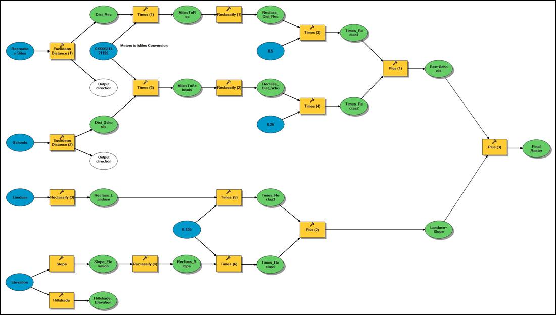
First, I imported the elevation, schools,
recreation sites and land use data. A default hillshade was built from the elevation data as well
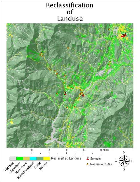
as Slope (in 7 class divisions). Landuse features were labeled and categorized by
appropriate color. The first real task
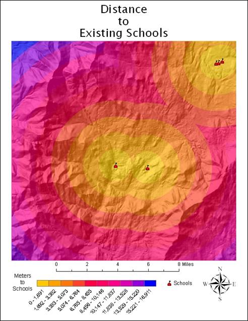
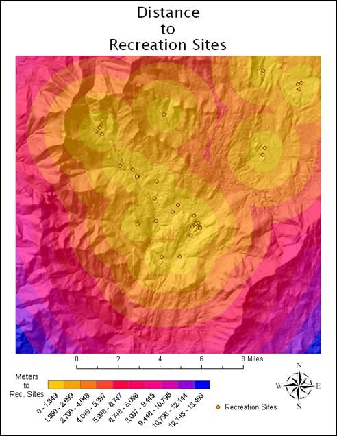
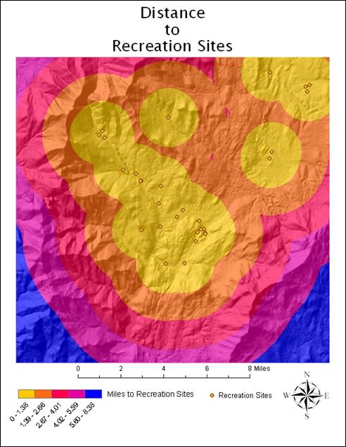
was to calculate Euclidean distance to Recreation Sites and distance to Existing
Schools. This was done with Spatial
Analyst. The units for these distances
were set to meters, which for the purpose of the map would be too difficult to
convey distance. So I used the raster
calculator in Spatial Analyst to convert to distances in miles. Now that all initial criteria
was mapped, I needed to reclassify the data to create a
mosaic. I reclassified the Landuse data to show the ranking from 1 to 5 (Agriculture
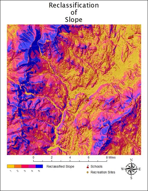
to Built Up) ñ Water and Wetlands features were classified as ìNot Used.î Slope was reclassified
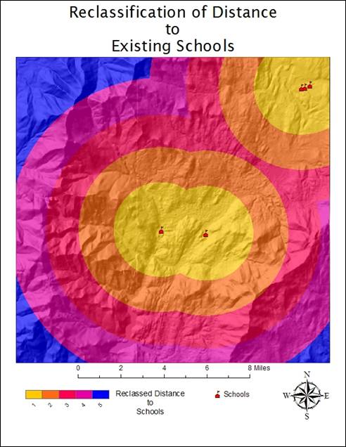
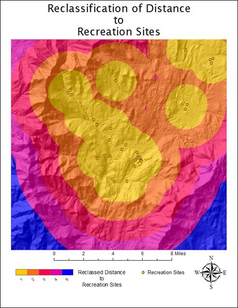
into a similar ranking (1 being the flattest and 5 being the steepest.) The mile distances to
the Existing Schools and to the Recreation Sites were reclassified to show a direct relation to the
5 class divisions of distance already mapped (1 being the closest zone and 5
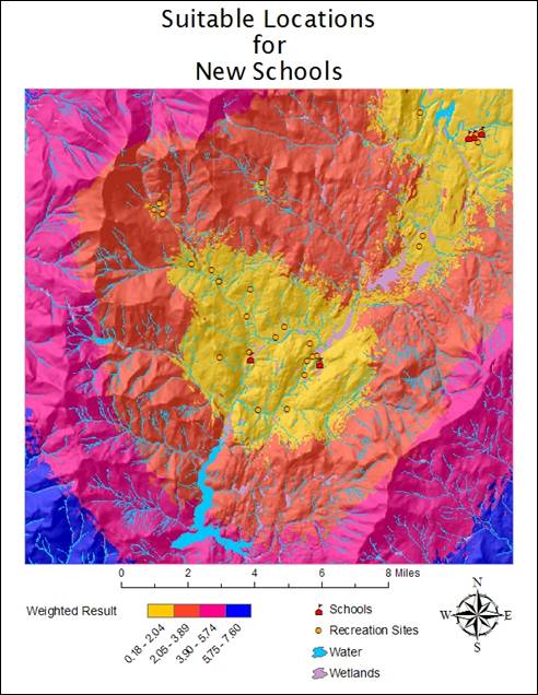
being the most distant.) A weighted mosaic of the reclassified data could then be made using
the following formula in the raster calculator:
[recl_dist_rec] * 0.5 + [recl_dist_school]
* 0.25 + [recl_slope] * 0.125 + [recl_landuse]
* 0.125
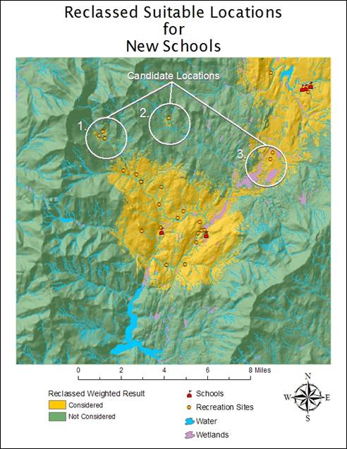
From this mosaic, I could immediately see three
favorable locations for a new school. Location #1 looks the most promising, as there are 3 recreation sites,
and it is within a convenient distance of the rest of
Model:
Landuse:
Slope:
|
Distance
to Schools (meters): |
Distance to Schools (miles): |
|
|
|

|
Distance
to Recreation Sites (meters): |
Distance to Recreation Sites (miles): |
|
|
|
Reclassification
of Landuse:
Reclassification
of Slope:
Reclassification
of Distance to Schools:
Reclassification
of Distance to Recreation Sites:
Mosaic of
Reclassified Landuse, Slope, Distance to Schools, and
Distance to Rec. Sites by Weight:
Reclassified
Suitable Locations for New Schools: