Todd Mitchell
GEOG-499c
Lab
3: Cartographic Modeling
|
Answers
to Lab Questions: |
1. Read GTKArcGIS Chapter11 and
Chapter 12, familiarize you with the issue in the two chapters. What are the
criteria used by the company in evaluating the forest?
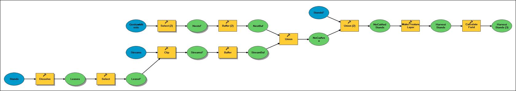
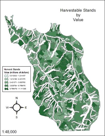
The
timber values of the potential lease areas needed to be calculated. The stands were dissolved into five lease
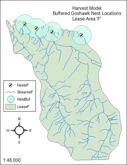
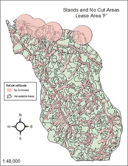
areas to determine how much each lease area was worth. Lease area ëFí (the most harvestable lease)
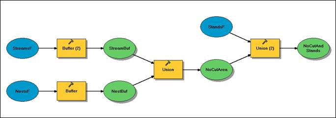
needed more definition in terms of non-harvestable streams and goshawk
nests. This definition was done with a
ëclipí of streams and ëselectioní of nests to the ëFí lease boundary. Government regulations prohibit logging
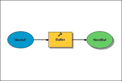
within an 800 meter distance from goshawk nests and 50 meters from streams (100
meters from salmon spawning areas). These areas were determined with ëbufferí and the resulting buffer
layers were joined by ëunioní into a ìNo Cut Area.î Finally, the value of just the harvestable
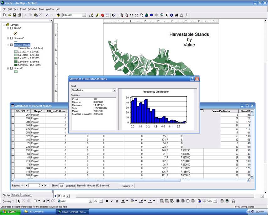
areas needed to be calculated. This was
done through definition query, and assigned a more accurate value to the
harvestable area within the lease.
2. Read GTK ArcGIS Chapter 20, answer
the following questions.
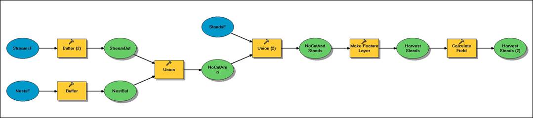
a. What are the major components in a flowchart (model)?
Input
data, a tool for a particular operation, and output data.
b. What are the advantages of using ModelBuilder?
ModelBuilder saves time by
eliminating repetitive spatial analyses and allowing the user to change
parameters in a model without reconstructing the entire workflow. It also helps users share information and
establish uniform practices.
|
Model 1: |
|
|
|
Map 1: |
|
|
|
Model 2: |
|
|
|
Map 2: |
|
|
|
Model 3: |
|
|
|
Map 3: |
|
|
Screen Grab:
Bonus Model: